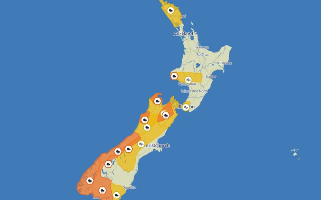
MetService's weather watches and warnings on the morning of 10 April. Weather watches are denoted by yellow, while warnings are orange. Photo: Supplied/MetService
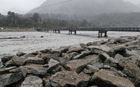
MetService might issue a red weather warning for Westland on Wednesday as the region is pummelled by heavy rain.
Large swathes of both the South and North Islands are already under either an orange weather warning or a yellow weather watch as a front moves slowly up the country.
But what do these colours mean? How serious does weather need to be before a warning or a watch is issued? And how do you know when a warning is in place?
Here's all the info you need.
The low-down on watches and warnings
MetService uses a three-tier, colour-coded warning system to alert New Zealanders when severe weather is on its way.
Weather watches are represented by the colour yellow, while weather warnings are generally orange. Red warnings are issued when there is extreme weather forecast which is likely to have a considerable impact.
The World Meteorological Organisation - of which New Zealand is a member - recommends the use of colour-coded warnings for severe weather.
They are also used by many other countries, including the United Kingdom and United States.
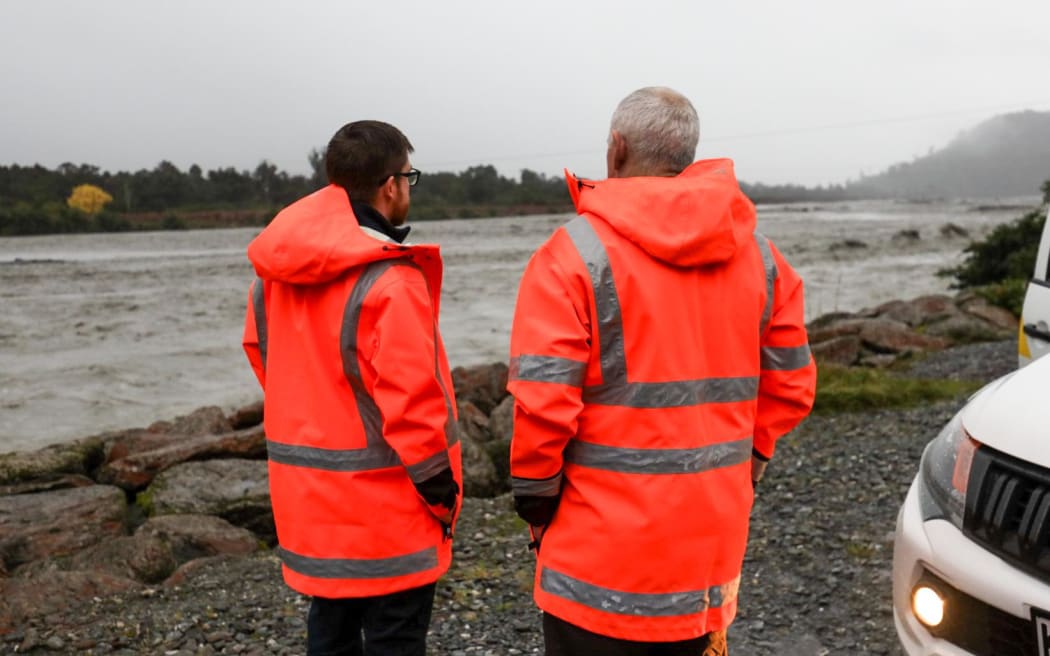
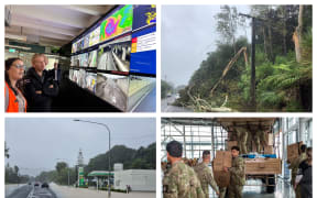
Staff from Emergency Management Otago assess the Waiho River as heavy rain hits Westland. Photo: RNZ/Nathan Mckinnon
Weather watches
Severe weather watches are issued when severe weather is possible, but not yet imminent or certain.
When a watch is in place, people are urged to stay alert and keep an eye on local forecasts for updates.
Watches are generally issued one to three days in advance of potential severe weather.
On MetService maps and other communications, watches are represented by the colour yellow and accompanied by a circle icon.
Orange weather warnings
These are issued when forecasters believe incoming weather will be bad enough to meet MetService's severe weather criteria.
For rainfall, that means greater than 50mm is expected to fall within six hours, or 100mm within 24 hours, over a widespread area (1000 square kilometres or more).
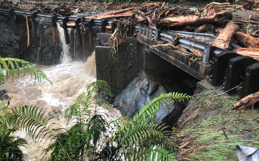
A slip has closed State Highway 6 between Fox Glacier and Franz Josef. Photo: Supplied/Stewart Glasson
For wind, that means widespread severe gales with a minimum mean speed of 90km/h, or frequent gusts exceeding 110km/h.
For snowfall, that means widespread snow below 1000 metres on the North Island, South Canterbury or Otago, or below 500 metres elsewhere on the South Island. For a warning to be issued, the snow depth must be expected to reach 10cm within six hours or 25cm within 24 hours.
MetService says when an orange weather warning is in place, people need to be prepared and take action as appropriate.
"There could be some disruption to their day and potential risk to people, animals and property."
The vast majority of weather warnings issued by MetService forecasters are orange. They are represented by a hexagon icon on MetService maps.
Red weather warnings
These are reserved for the country's most extreme weather, when significant disruption and safety issues are expected.
Anticipated outcomes of weather systems requiring a red warning are widespread power outages, washed-out roads and bridges, toppled trees, isolated communities, large slips and evacuations.
Red warnings signify that immediate action is needed to protect people, animals and property from the impact of the weather, MetService says.
"People should also be prepared to follow the advice of official authorities and emergency services."
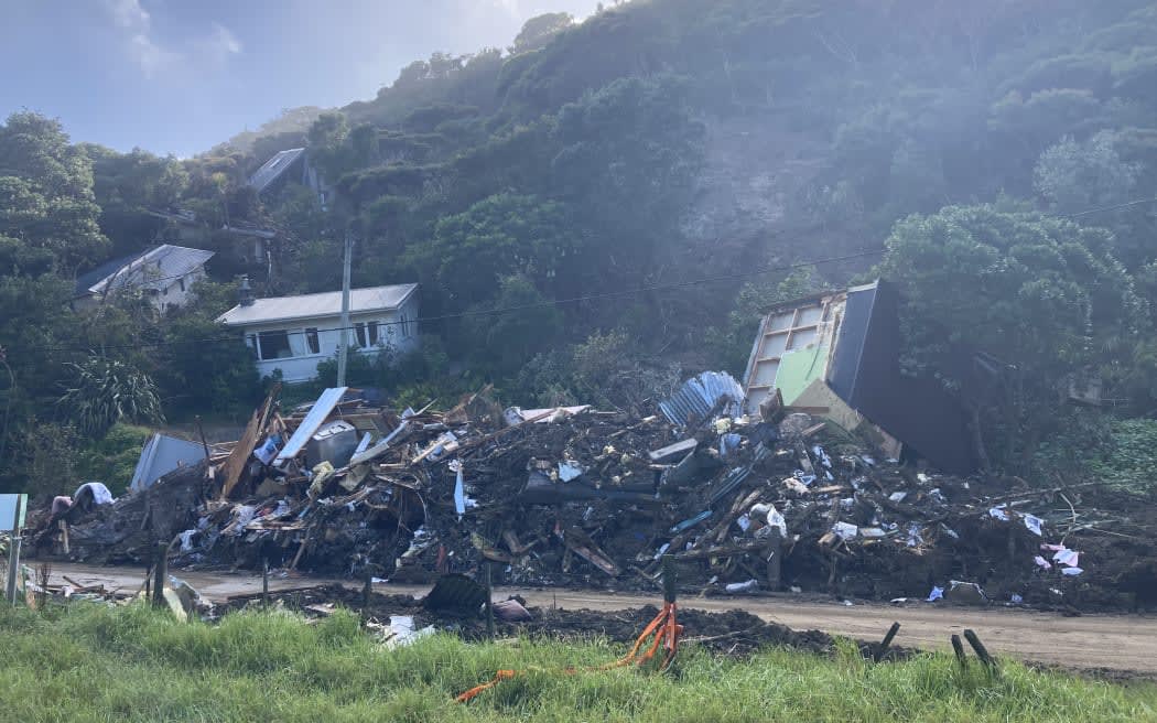
A red weather warning was issued before Cyclone Gabrielle, which killed 11 people and devastated communities. Photo: Leonard Powell
On MetService maps, red warning icons are represented by a triangle.
Red weather warnings were introduced in May 2019 and were only used seven times in their first three years of existence, including for the Canterbury flooding in May 2021 and the 2022 flooding in Gisborne and Wairoa.
More recently, red warnings were issued for parts of the North Island ahead of the Auckland floods and Cyclone Gabrielle.
The vast majority of weather systems for which MetService issued a red warning were so severe that they resulted in local or regional states of emergency being declared.
Severe thunderstorm warnings
Severe thunderstorm warnings are separate to severe weather warnings, and are issued when a storm with one or more of the following criteria is forecast:
- Heavy rain of 25mm per hour or more
- Large hail of 20mm diameter or more
- Strong wind gusts of 110km/h or more
- Damaging tornadoes with wind speeds more than 116km/h
Severe thunderstorm warnings are not differentiated by orange and red. They are only ever signified by the colour red.
How to know when a watch or warning has been issued
Up-to-date information can be found at MetService's warnings and watches page.
In the case of extreme weather, RNZ is New Zealand's statutory civil defence lifeline radio broadcaster, providing vital information and updates as they come to hand.
The National Emergency Management Agency (Nema) advises that in times of crisis or civil defence emergency, a battery-powered radio or a car radio remain essential lifelines if power is out and other forms of communication are unavailable.
We have AM and FM transmitters covering a large percentage of New Zealand. Check out the frequencies here.
You can also stream RNZ through the website or app or follow us on Facebook, Instagram or TikTok. .
We livestream Civil Defence updates on our YouTube channel.